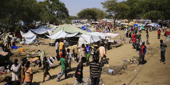
 The main problem in solving the food shortage crisis is how to track food security in areas that are too remote or too dangerous to enter.
The world is watching closely as food shortages grip the region in Africa and the Middle East. When humanitarian groups respond to a crisis, they must solve a major problem: how to track food security in areas that are too remote or too dangerous to enter.
Famine Early Warning Systems Network (FEWSNET) has emerged with innovative answers. The US-funded organization works there with DigitalGlobe, a satellite company from Colorado, to collect South Sudan satellite image analysis from the public.
This effort will rely on thousands of volunteers - ordinary people without expertise in the field - to check satellite imagery to look for things like cattle, temporary shelter, and permanent dwellings. The group has selected an area of 18,000 square kilometers spanning five districts in Southern Sudan for further analysis.

"This group of people can identify the image of the settlement, they can recognize the highway, the hospital, the airplane, call it that. This program allows us to utilize networks of people from all over the world, not necessarily domestically, but interested people and feel obliged to participate in campaigns for any purpose, "said Rhiannan Price, senior manager at Seeing a Better World Program at DigitalGlobe.
"Rather than clicking on the phone and passively retrieving the information, our users are actively involved and supplying information that is really helpful to our partners."
The DigitalGlobe platform known as Tomnod, has 2 million unique users. Other observational campaigns also used public gatherings using satellite imagery including the effects of wildfires in South Africa and efforts to count seals in Antarctica.
But efforts in Southern Sudan are particularly valuable, with an estimated 100,000 people forced to flee their homes in five districts due to violence. Conflict-prone South Sudan is the only place in the world where famine has been declared within the last six years.
"In order for a humanitarian campaign to cover such an area, especially if the area is not safe, it is not a safe approach at all," Price said. "Satellite images offer a very useful tool when it comes to assessing and evaluating what's happening on land, trying to find these people so we can get the resources and measure the situation there."
DigitalGlobe owns and operates a high-resolution satellite constellation and has collected thousands of recent satellite imagery in the questionable area. In order to track damage and displacement in the best way, they compared satellite imagery from 2005, when we undertook a similar project.
Chris Hillbruner, vice chief of party at FEWSNET, said his organization is trying several innovative approaches in various parts of the world to collect data. In Yemen and northeastern Nigeria, the organization has brought together a network of local data collectors that transmit information. In addition, the organization has also launched a pilot project using mobile phones to collect wage and market-related data in Madagascar to determine when labor demand will decline, as a sign of a poor harvest season for that year.
"We became the first users of a variety of tools and I think technology can help us, but I think there are still many limitations," says Hillbruner. "In the end, we will still rely on people to get the best information if they can enter the area and go to the field to gather information to find out what is really going on."
But high resolution satellite imagery, where every pixel in the photo shows an area of 30 centimeters, maybe the next best thing is to send people to the field.
To date, the Tomnod volunteer team has identified more than 180,000 important objects, including a traditional settlement called tukul and a herd of livestock. It is invaluable information that informs the humanitarian organizations on which to send assistance.
"When you think about some of the driving factors behind food insecurity, things like conflict or drought or floods, things that affect food supply, or affect the migration of people, it's an area where remote sensing, satellite imagery, Really shows its superiority is unmatched by any other way of analysis, "Price said
.jpg)
Komentar